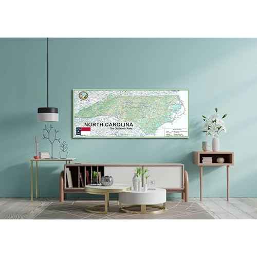
North Carolina sits in the Southeastern with Raleigh serving as capital and Charlotte as the largest, plus the 21st-most populous US metropolitan area and the US's biggest banking center outside of New York. It is bordered by Virginia to the north, the Atlantic Ocean to the east, Georgia and South Carolina to the south, and Tennessee to the west.
Our North Carolina State Map showcases its geography, with easy-to-read text, and features like capital cities, rivers, major roads, towns, and bodies of water. It's perfect for any room, office, or school, and a great way to gain a comprehensive view of the country.
Size - 13.3 x 30 inches.
Printed onto high quality paper and laminated for durability.